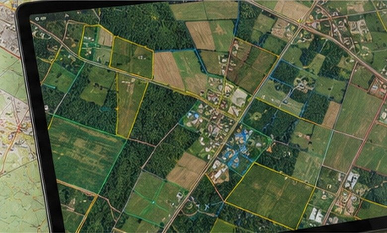
Yancey County GIS makes property maps easier to explore, find parcels, addresses, tax data, and land information with confidence.
Yancey County GIS is the county’s online geographic information system for viewing mapped property and geographic information, including parcels, roads, surface water, elevations, and aerial imagery. The official county GIS page provides access to the interactive map and public GIS data downloads.
For property research, start with the official Yancey County GIS map, but treat the map as a research tool rather than a substitute for a recorded deed, survey, or other authoritative legal document.
What You'll Discover:
Why Yancey County GIS Matters
A property can look simple from the road and surprisingly complicated on paper.
One parcel may have an irregular boundary, a long driveway, nearby streams, multiple structures, or an address that doesn’t line up neatly with what you see on a conventional map. GIS brings many of those pieces together on one screen.
Yancey County describes its GIS data as covering items such as parcels, street centerlines, surface water, elevation contours, and aerial imagery. The county develops and maintains this information for government functions and public services.
Yancey County GIS is a geographic research tool, not a legal survey of your property.
That distinction matters most when you’re buying land, planning construction, resolving a boundary question, or making a financial decision based on acreage or ownership information.
How to Access the Official Yancey County GIS Map
The simplest starting point is the county government’s GIS page, which links directly to the Yancey County GIS Maps application. The same page also provides a public GIS data download option.
If the interactive map is temporarily slow or certain functions aren’t working, that may not be your browser. In August 2026, Yancey County posted a notice saying its GIS website was undergoing maintenance and that users could experience problems with performance and some functions.
That is useful context when troubleshooting. A broken search function doesn’t necessarily mean you’ve entered the wrong parcel information.
What You Can Find in Yancey County GIS
Parcel boundaries and property locations
The parcel layer is usually the first thing people want.
A parcel is a mapped piece of land associated with property records. Selecting a parcel can help you identify its location and connect the map with information used for property administration and taxation.
North Carolina’s statewide parcel program similarly describes parcel data as including boundaries and core attributes such as ownership, acreage, and assessed value. The statewide system combines information supplied by county data producers while retaining the source geometry.
Roads and addresses
GIS also helps connect land to the county’s addressing system.
Yancey County’s Addressing & Mapping Department maintains the county’s E-911 database and GIS for road centerlines and addresses. The department also handles new addresses and address changes when inconsistencies are identified or new construction requires an address.
This makes GIS useful for more than finding property. It can also help emergency services, residents, contractors, delivery services, and government agencies understand where a structure is located.
Water, elevation, and aerial imagery
Property boundaries are only one layer of the story.
The county identifies surface water, elevation contours, and aerial imagery among its GIS data. Those layers can provide valuable context when you’re evaluating a rural property, looking at terrain, or trying to understand why a parcel’s buildable area may be much smaller than its total acreage.
A 20-acre tract, for example, does not automatically mean 20 acres of convenient building land. Steep terrain, streams, access limitations, easements, or other constraints can change the practical value of the property.
How to Search for a Yancey County Property
The exact controls can change as the county updates its mapping application, but the basic research process is straightforward.
Start with the information you already have
The most useful starting information may be:
- Property address
- Owner name
- Parcel or PIN number
- Road name
- Approximate location
- Deed or tax-record information
If you have a parcel number, use it whenever possible. It is generally more precise than trying to identify a rural property from a partial street address.
Locate the parcel on the map
Once you’ve found the property, select the parcel and examine its boundary relative to roads, buildings, waterways, and neighboring parcels.
Don’t stop at the first result.
Zoom in and out. Look at surrounding parcels. Switch relevant layers on and off. Then compare what the GIS shows with the property’s deed, tax records, and what you can actually observe on the ground.
Record the important details
For serious property research, don’t rely on memory or a screenshot alone.
Write down the parcel identifier, property address, owner information displayed by the system, acreage, assessed information, and anything unusual about the parcel’s shape or location.
This creates a useful starting record if you later need to contact the county or compare the information against recorded documents.
Yancey County GIS vs. Tax Records vs. Deeds
One of the easiest mistakes is assuming these sources all do the same job.
They don’t.
| Source | Best for | What it should not replace |
| Yancey County GIS | Maps, parcel location, geographic context | A legal survey or deed |
| Tax records | Assessment, taxation, billing information | A determination of legal boundaries |
| Register of Deeds | Recorded deeds and land documents | A visual GIS map |
| Professional survey | Establishing property boundaries on the ground | General-purpose mapping |
North Carolina’s Secretary of State explains that tax maps are used by counties to assess taxes and contain an inventory of land parcels, tax values, and ownership information. It also recommends checking deeds and county records when determining ownership.
That distinction becomes critical during a property purchase.
A GIS line can show you where a parcel is mapped; it does not automatically establish where a legal boundary exists on the ground.
When GIS Is Useful for Buying Land
Suppose you’re considering a wooded property outside Burnsville.
The listing says 12 acres. Before becoming emotionally attached to the mountain view, you can use GIS to examine the parcel’s shape, nearby roads, surrounding ownership, terrain-related information, and mapped features.
That doesn’t tell you whether the property is perfect.
It tells you what questions to ask next.
For example, you might discover that the parcel is unusually narrow, appears to have limited road frontage, or is crossed by a mapped water feature. Those discoveries don’t necessarily make the property unusable, but they can change what you need to investigate before making an offer.
Using GIS for Property Tax Research
Yancey County’s Tax Department handles property-tax assessment and collection records and is responsible for maintaining records used to appraise, assess, bill, and collect taxes on real and personal property.
GIS and tax information therefore work well together.
If you’re trying to understand why a property appears to have a particular assessed value, GIS can help you identify the parcel and its location, while the tax records provide the assessment information itself.
The Town of Burnsville also directs people seeking parcel or valuation information to Yancey County’s GIS resources.
What Yancey County GIS Does Not Tell You
This is where careful property research separates itself from casual map browsing.
It does not establish a legal boundary
A parcel polygon is a mapped representation of property.
If two neighbors disagree about the precise location of a boundary, the appropriate evidence may include deeds, plats, recorded documents, monuments, and ultimately a survey by a qualified professional, not simply which line looks correct on a computer screen.
It does not guarantee current conditions
GIS databases are maintained and updated, but different layers can originate from different sources and dates.
The county explicitly warns users to verify information derived from its GIS data before making decisions or taking actions.
It does not answer every zoning question
The county’s GIS page specifically directs zoning questions to the Town of Burnsville Public Works Department.
That’s an important reminder: the department responsible for maintaining a map may not be the department responsible for interpreting every regulation associated with the land.
A Better Property-Research Workflow
For anything more important than casual browsing, use GIS as the first step in a larger verification process.
Step 1: Find the parcel
Search the official GIS map using the best identifier available.
Step 2: Examine neighboring properties
Look beyond the target parcel. Roads, neighboring parcels, streams, and surrounding development can reveal context that an isolated property view hides.
Step 3: Check tax information
Compare the parcel information with current assessment and tax records.
Step 4: Check recorded documents
Use the appropriate Register of Deeds records to investigate deeds, plats, easements, and other recorded documents.
Step 5: Verify restrictions separately
If you’re considering development, investigate zoning, septic requirements, flood considerations, access, building regulations, and other restrictions through the appropriate authorities.
Step 6: Get professional verification when the stakes are high
If the exact boundary affects a purchase, construction project, driveway, fence, subdivision, or dispute, hire a licensed surveyor rather than relying on a GIS screen.
Recent Changes and Data Reliability
GIS isn’t a static paper map.
Yancey County continues to maintain its mapping infrastructure, and the county’s public notices show that the GIS website was undergoing technical maintenance in August 2026.
At the state level, NC OneMap provides a standardized statewide parcel resource built from county and other participating data sources. It is particularly useful when your research crosses county lines or you need standardized North Carolina parcel information.
The statewide parcel service includes standardized attributes and represents parcels as both polygons and points, making it useful for mapping, analysis, emergency management, planning, and other applications.
For Yancey County-specific questions, however, the county’s own GIS and mapping staff remain the better starting point.
Common Mistakes to Avoid
Treating the map line as a survey
This is probably the biggest mistake.
A GIS map is excellent for locating and researching property but isn’t automatically precise enough to establish a legal boundary.
Assuming acreage is exact
Mapped acreage can differ from figures appearing in deeds, surveys, or other records because measurements and source data can differ.
Confusing assessed value with market value
A tax assessment is used for property-tax purposes. It shouldn’t automatically be interpreted as the amount a buyer would pay in the open market.
Ignoring the data’s purpose
Yancey County itself cautions that its distributed GIS information may not be suitable for every purpose and asks users to verify information before relying on it.
That warning isn’t a footnote to ignore. It’s one of the most important pieces of information on the county’s GIS page.
Frequently Asked Questions
What is Yancey County GIS?
Yancey County GIS is the county’s geographic information system for organizing and displaying spatial information such as parcels, roads, surface water, elevation, and aerial imagery.
How do I find a property on Yancey County GIS?
Start with the official county GIS map and use the property information available to you, such as an address, owner name, or parcel identifier. Once located, select the parcel to inspect its mapped information.
Is Yancey County GIS free?
The county provides public access to its GIS map and also links to public GIS data downloads from its official website.
Can I use GIS to determine my exact property boundary?
Not reliably enough for a legal boundary determination. GIS is useful for research, but a boundary question may require deeds, recorded plats, and a professional land survey.
Who should I contact about Yancey County GIS?
The county’s Addressing & Mapping Department is located at 322 W Main Street, Suite A, Burnsville, NC 28714. The department lists 828-682-2347 as its phone number, and the county identifies Jeff Boone as Land Records/GIS Analyst.
Key Takeaways
- Yancey County GIS is the county’s primary public mapping resource for parcels and geographic information.
- The official system includes information such as parcel boundaries, roads, surface water, elevation contours, and aerial imagery.
- Use GIS to find and understand a property, not as a replacement for a deed or professional survey.
- Tax records and GIS complement one another but serve different purposes.
- For ownership and recorded land documents, check the appropriate Register of Deeds records.
- For zoning and regulatory questions, contact the responsible local department rather than assuming the GIS map provides the answer.
- When a property decision has significant financial or legal consequences, verify the GIS information with authoritative records and qualified professionals.
Additional Resources
- North Carolina Secretary of State: Explains how deeds, tax maps, county offices, and online land records work together when researching ownership and property information.