Tazewell County GIS makes property research easier. Learn how to find parcels, maps, assessments, and records with confidence.
If you mean Tazewell County, Illinois, the county’s GIS viewer lets you explore parcels, property boundaries, roads, taxing districts, zoning-related layers, aerial imagery, and other geographic information. The county also provides a separate property-tax search for assessment details, while recorded deeds and other legal documents are handled through the County Clerk & Recorder.
The important distinction is that a GIS map is a research tool, not a substitute for a legal survey or title search.
A property map can answer a surprisingly complicated question in seconds: What exactly is this piece of land?
That’s why the Tazewell County GIS viewer is useful to homeowners, prospective buyers, developers, contractors, researchers, and anyone trying to make sense of a parcel. Instead of jumping between disconnected records, GIS brings geographic information together visually.
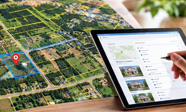
For Tazewell County, Illinois, the county’s current public GIS system includes ownership parcels, parcel dimensions, subdivisions, roads, taxing districts, farms data, hydrography, and zoning and enterprise-zone information. The underlying ArcGIS project was updated in 2026 and includes 2026 aerial imagery.
But there’s a catch that is easy to miss: seeing something on a county map does not automatically make it a legally established boundary, ownership record, or development approval.
Understanding what the map can, and cannot, tell you is the key to using it properly.
What You'll Discover:
What Is Tazewell County GIS?
GIS stands for Geographic Information System. Think of it as a digital map made from layers rather than one static picture.
One layer might show parcels. Another can show roads. Another can display taxing districts, subdivisions, aerial imagery, or other geographic information. Tazewell County’s GIS system uses this layered approach to make complicated location-based records easier to explore. The Tri-County Regional Planning Commission describes GIS as a way to capture, manage, and display multiple layers of data in a single map.
The county’s public GIS viewer currently includes layers for ownership parcels and parcel dimensions, cadastral information, subdivisions, condominiums, transportation, hydrography, taxing districts, farms, and zoning and enterprise zones.
That makes the viewer useful for much more than simply locating a house.
What you can typically investigate
A Tazewell County GIS map can help you investigate:
- Parcel location and shape
- Parcel dimensions
- Property-related geographic layers
- Roads and transportation features
- Subdivisions and lots
- Taxing districts
- Aerial imagery
- Farms and agricultural areas
- Zoning and enterprise-zone information
- Schools and school districts
- Geographic relationships between neighboring properties
The exact information displayed depends on the layer selected and the county’s current data.
How to Find a Property on the Tazewell County GIS Map
The easiest starting point is the county’s official Property GIS Search, linked from the Tazewell County Assessment Office. The same county page also links to the separate property-tax search and the county’s ArcGIS home page.
If you’re researching a specific property, have as much identifying information as possible before opening the map.
Search by address or parcel information
An address is usually the most intuitive starting point for a homeowner or buyer. A parcel identification number can be more useful when researching a property that has an unusual address, multiple structures, or several adjacent parcels.
Once you’ve located the property, zoom in and examine the parcel layer rather than relying solely on the aerial photograph.
This matters because aerial imagery answers “What appears to be there?”, while parcel information answers a different question: “How has the property been mapped in the county’s cadastral records?”
Turn layers on and off
GIS becomes much more useful when you stop treating it like Google Maps and start treating it like a stack of transparent sheets.
For example, someone considering a commercial property might compare the parcel boundary with roads, taxing districts, zoning-related information, and nearby development. A homeowner might instead focus on the parcel outline, lot dimensions, aerial imagery, and neighboring parcels.
The county’s current GIS project contains separate layers for these kinds of information rather than presenting everything as one undifferentiated map.
Tazewell County GIS vs. Property Tax Records
One of the most common sources of confusion is assuming that the GIS map and property-tax database are the same thing.
They are connected, but they serve different purposes.
| Resource | Best for | What it tells you |
| County GIS viewer | Mapping and location | Parcels, dimensions, roads, geographic layers and imagery |
| Property tax search | Assessment research | Property assessment and related tax-record information |
| County Clerk & Recorder | Recorded documents | Deeds, recorded instruments, plats and other land records |
| Professional survey | Establishing boundaries | Surveyed boundary information for a specific property |
Tazewell County’s Assessment Office separately links to its Property Tax Search/Property Sketches/Structures Data and its Property GIS Search, which is a useful indication that these systems answer different questions.
The County Clerk & Recorder, meanwhile, provides recorder services including remote access and recorded-document resources.
A GIS parcel map is a starting point for property research, not the entire property record.
Can Tazewell County GIS Show Property Lines?
Yes, the public GIS viewer includes ownership parcel and parcel-dimension layers. The county’s GIS data also includes cadastral layers such as lots, blocks, subdivisions, rights-of-way, and condominiums.
That doesn’t mean the map should be used to settle a boundary dispute.
For example, imagine your GIS map appears to show the property line running several feet from an existing fence. That observation can be useful, it may prompt you to investigate the deed, recorded plat, monuments, or a professional survey. It should not automatically lead you to move the fence.
The Village of Morton specifically points residents toward the Tazewell County GIS Viewer for viewing lot dimensions while noting that the village does not employ a surveyor to mark property lines.
Why GIS boundaries aren’t the same as a survey
A parcel layer is designed for mapping and administrative purposes. A boundary survey is a professional determination based on applicable records, measurements, monuments, legal descriptions, and surveying standards.
That distinction becomes especially important before:
- Building a fence
- Purchasing a narrow strip of land
- Constructing near a boundary
- Disputing a neighbor’s claimed property
- Creating or splitting a parcel
- Making a major land-development decision
Use GIS to investigate a boundary; use a qualified surveyor when the exact legal boundary matters.
How Tazewell County GIS Helps With Property Taxes
GIS can make assessment research much easier because property characteristics become spatially understandable.
Suppose the county’s assessment record lists a parcel with improvements. Looking at the property geographically can help you understand where that parcel sits, how it relates to neighboring parcels, and what structures or geographic features appear on the map.
Tazewell County’s Assessment Office provides both GIS access and property-tax search resources from its official assessment page.
There is also an important Illinois-specific point: property assessment and market value are not interchangeable terms.
Illinois law establishes a statutory assessment level of 33.33% of fair cash value, with equalization procedures used to bring assessment levels to the required level. The Illinois Department of Revenue explains that equalization factors are based on sales-ratio analysis.
So if you see an assessed value in a property record, don’t automatically interpret that number as the property’s current market price.
What Tazewell County GIS Is Useful For
The real strength of GIS is comparison.
Homeowners
A homeowner can use the map to understand the shape and location of a parcel, investigate neighboring parcels, and explore relevant geographic layers.
If you’re planning an addition or other improvement, GIS can be a helpful first research step before contacting the appropriate local authority.
Buyers
For a prospective buyer, GIS can provide useful context before making an offer.
You might examine the parcel’s relationship to roads, neighboring properties, subdivisions, taxing districts, and other mapped features. Then you can verify important findings through the appropriate county records and professionals.
Developers and businesses
GIS can provide a broader geographic picture when evaluating land.
Tazewell County’s public GIS includes zoning and enterprise-zone-related layers, while the City of Pekin directs businesses and developers to the Tazewell County GIS map as one of its development resources.
Still, a map layer should not be treated as the final word on whether a particular project is permitted. Development decisions can involve municipal zoning, county requirements, recorded restrictions, utilities, access, environmental considerations, and other approvals.
What Tazewell County GIS Does Not Prove
This is where a little caution can save a lot of trouble.
A GIS map generally should not be treated as definitive proof of:
- Legal title
- A precise surveyed boundary
- An easement’s complete legal terms
- A property’s buildable area
- Current zoning approval for a proposed project
- The absence of liens or other encumbrances
- The legality of an existing structure
- The exact location of underground utilities
The county’s own GIS disclaimer, reproduced in county materials, says its parcel and map records are intended for property-tax purposes and should not be relied upon as a substitute for a title search. It also states that the data can change.
That’s an unusually important detail for anyone using the map to make a real-world decision.
A Practical Property Research Workflow
If you’re investigating a Tazewell County property, a simple sequence works well:
- Locate the parcel in the county GIS viewer.
- Record the parcel identification information.
- Examine the parcel boundary and relevant map layers.
- Check the county property-tax and assessment records.
- Review recorded documents through the County Clerk & Recorder when ownership or legal interests matter.
- Contact the appropriate municipal or county department for zoning, permits, or development questions.
- Hire a surveyor or other qualified professional when the decision depends on exact boundaries or legal rights.
This approach prevents a common mistake: trying to force one map to answer six different legal, tax, planning, and surveying questions.
Tazewell County GIS Resources at a Glance
| Need | Where to start |
| View parcel maps | County GIS viewer |
| Research assessments | Tazewell County Assessment Office |
| Look up property-tax information | County property-tax search |
| Investigate recorded land documents | County Clerk & Recorder |
| Explore regional GIS resources | Tri-County Regional Planning Commission |
| Determine an exact property boundary | Professional land survey |
The county’s GIS department is also listed directly among Tazewell County departments, and the Assessment Office provides a direct link to the public GIS search.
Frequently Asked Questions
Is Tazewell County GIS free to use?
The county provides a public GIS search through its website. The Assessment Office links directly to the Property GIS Search and related public property resources.
Can I use Tazewell County GIS to find my property owner?
GIS can help identify and locate a parcel, but ownership and recorded legal interests should be verified through the appropriate county property and recorder records rather than relying on a map alone.
Does Tazewell County GIS show lot dimensions?
Yes. The current public GIS project includes ownership parcel dimensions and other cadastral layers.
Is a GIS property line legally accurate?
A GIS parcel boundary is useful for reference and research, but it should not replace a professional boundary survey when the precise legal location of a property line matters.
Is Tazewell County GIS the same as the property-tax search?
No. The county provides separate GIS and property-tax/assessment resources. GIS emphasizes geographic information, while the assessment and tax systems provide property-record information.
Key Takeaways
- Tazewell County GIS is a powerful public mapping tool for Tazewell County, Illinois.
- The current public GIS includes parcel, cadastral, transportation, taxing-district, zoning-related, school, farm, and aerial-imagery layers.
- The GIS viewer and property-tax search serve different purposes and should be used together when researching a property.
- GIS parcel lines are useful for investigation but should not automatically be treated as surveyed legal boundaries.
- Recorded deeds and other land documents belong in the property-research process when legal ownership or interests matter.
- Illinois property assessments should not be confused with current market value; the state uses a statutory 33.33% assessment level and equalization procedures.
- For a high-stakes property decision, treat GIS as the map that helps you ask better questions, not as the final answer.
Additional Resources
- Tazewell County Assessment Office: This is the county’s central starting point for property GIS, tax searches, assessment information, exemption forms, and assessor contacts.