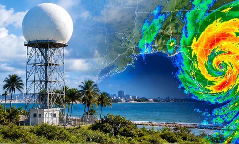
Port Charlotte weather radar made simple: track rain, thunderstorms, flooding, and tropical weather with confidence.
For the most authoritative Port Charlotte weather radar, use the serving southwest Florida, particularly the KTBW radar operated from Ruskin. The NWS provides both local and regional radar views, while services such as AccuWeather and Weather Underground offer additional map layers and local observations.
Radar is most useful for answering one immediate question: Where is precipitation now, and where is it moving? It is not, by itself, a complete forecast or a guarantee that rain will, or will not, reach your exact street.
What You'll Discover:
Why Port Charlotte Weather Radar Is Worth Checking
A weather forecast might tell you there is a 60% chance of thunderstorms this afternoon. Radar answers a different question: Are those storms actually approaching Port Charlotte right now?
That distinction matters in southwest Florida, where summer thunderstorms can be highly localized. One neighborhood may get a downpour while another several miles away stays mostly dry.
The National Weather Service’s Tampa Bay office provides a dedicated local KTBW radar, regional radar, radar loops, satellite imagery, observed precipitation and current hazards. Its office is located in Ruskin and serves the broader Tampa Bay and west-central Florida region.
Radar shows where precipitation is occurring; a forecast explains what weather is expected next.
For everyday decisions, driving, boating, outdoor work, beach plans or watching an approaching thunderstorm, that difference is surprisingly important.
How to Find the Port Charlotte Radar
The simplest authoritative option is the system.
The NWS radar interface can display a weather-for-location view that combines radar, current conditions, alerts and forecasts. It also offers individual radar-station products and a national radar mosaic. ()
For Port Charlotte specifically, the Tampa Bay NWS office provides access to Local KTBW Radar, enhanced radar, regional radar and radar loops.
Commercial radar maps can also be useful. AccuWeather’s Port Charlotte radar, for example, displays precipitation type and recent movement, while Weather Underground combines radar with observations from its personal weather-station network.
The important point is not to treat every colorful radar map as interchangeable. The underlying radar observations may be similar, but the interface, forecast overlays and interpretation tools can differ.
How to Read Port Charlotte Weather Radar
Start With the Radar Loop
A single radar image is a snapshot. A loop is a short movie.
That distinction is crucial. Suppose you see a yellow or orange area west of Port Charlotte. The color tells you something about the radar return, but it does not tell you whether the rain is moving toward Port Charlotte, away from it or dissipating.
Watch several frames and look for three things:
- Direction: Which way is the precipitation moving?
- Speed: How quickly is the area approaching?
- Trend: Is it strengthening, weakening or maintaining its structure?
A storm 30 miles away moving rapidly toward Port Charlotte deserves more attention than a stronger-looking cell moving away.
Understand the Colors
Most public radar displays use colors to represent reflectivity, measured in decibels relative to Z, or dBZ.
Generally, higher reflectivity corresponds to heavier precipitation, although radar does not directly measure rainfall at the ground. NOAA notes that reflectivity depends heavily on the size and concentration of particles returning energy to the radar.
A rough interpretation is:
| Radar signal | General indication |
| Under 20 dBZ | Very light precipitation or clutter |
| 20–40 dBZ | Light precipitation |
| 40–50 dBZ | Moderate precipitation |
| 50–65 dBZ | Heavy precipitation; hail may occur |
| Above 65 dBZ | Extremely heavy precipitation and possible hail |
These ranges are guidelines, not a promise of a particular rainfall rate. NOAA specifically cautions that radar reflectivity is not the same thing as measured rainfall at the surface.
Don’t Assume Red Means “Tornado”
This is one of the easiest radar mistakes to make.
A bright red or purple patch generally means a strong radar return. It can indicate very heavy rain or hail, but the color itself does not establish that a tornado is occurring.
Forecasters examine velocity data, storm structure, environmental conditions, warnings and other information when evaluating severe thunderstorms.
NOAA’s NEXRAD system includes products such as base velocity, storm-relative velocity, spectrum width and dual-polarization products specifically because precipitation intensity alone cannot tell the whole story.
What Port Charlotte Radar Can, and Can’t, Tell You
Radar is extraordinarily useful, but it has limitations.
Think of it like a flashlight shining through the atmosphere. You can see what reflects the beam, but what you see depends on distance, elevation, atmospheric conditions and the characteristics of the target.
| Radar can help you see | Radar cannot reliably tell you alone |
| Where precipitation is occurring | Exactly how much rain your yard will receive |
| Movement of rain bands | Whether every storm cell will continue strengthening |
| Areas of heavier radar returns | Whether a tornado is occurring from color alone |
| Storm structure | Exact rainfall timing at your street |
| Possible hail signatures | Whether roads are currently flooded |
| Wind information through velocity products | The complete weather forecast |
One particularly important limitation is beam height. As the radar beam travels farther from the radar site, it samples progressively higher portions of the atmosphere. NOAA explains that this can cause precipitation near the ground to be missed or underestimated at greater ranges.
That is one reason radar should be combined with surface observations, forecasts and local warnings rather than treated as a crystal ball.
Why Radar Matters So Much in Port Charlotte
Port Charlotte’s location on Florida’s Gulf Coast makes rapidly changing rain and thunderstorm conditions especially relevant.
During the warm season, thunderstorms can develop or intensify quickly. A forecast saying “scattered thunderstorms” does not mean the entire area will receive the same weather at the same time.
For someone planning a round of golf, outdoor work or a boat trip, radar can therefore be more useful than a daily percentage of precipitation.
The practical question becomes: Is the storm actually heading toward me?
Using Radar for Everyday Decisions
Before Driving
Check the radar loop rather than simply looking at the current radar image.
If a narrow but intense line of thunderstorms is moving across your route, waiting 20–30 minutes may produce a very different driving experience. Remember, however, that radar cannot tell you whether a particular underpass or low-lying road is flooded.
For flooding, use official warnings and local road information in addition to radar.
Before Going to the Beach
Florida’s coastal weather can change quickly, particularly when thunderstorms develop inland and propagate toward the coast.
Look for nearby cells, their direction of movement and lightning-related warnings. If thunder is audible, treat that as a reason to leave exposed areas rather than waiting for the radar colors to become more dramatic.
Before Boating
Radar becomes even more valuable on the water because storms can bring lightning, strong winds, heavy rain and reduced visibility.
For marine decisions, don’t rely on precipitation radar alone. Combine radar with the marine forecast, wind information, lightning information and official warnings.
During a Heavy Downpour
This is where radar’s greatest practical value may be its ability to show whether the intense rainfall is part of a larger system.
A small cell passing quickly may produce a short burst of rain. A slow-moving or repeatedly developing line can produce much more substantial rainfall even if its radar colors do not look spectacular at every moment.
Radar vs. Forecast: Which Should You Trust?
It is better to think of radar and forecasts as different tools rather than competitors.
| Tool | Best question it answers |
| Radar | What’s happening now? |
| Radar loop | Where is it going? |
| Hourly forecast | What is expected over the next several hours? |
| Severe weather alerts | Is there an officially identified hazard? |
| Satellite | What large-scale cloud patterns are developing? |
| Rain gauge | How much rain actually fell here? |
| Hurricane forecast | Where could a tropical system go and how could it develop? |
The strongest approach is to combine them.
If radar shows a storm 15 miles away, the hourly forecast gives a high chance of thunderstorms, and the NWS has issued an alert, those pieces of information reinforce one another.
If the forecast says rain is likely but radar is clear, that does not necessarily mean the forecast is wrong. The rain may simply be expected to develop later.
Port Charlotte Radar During Hurricane Season
Radar becomes particularly valuable when tropical weather threatens southwest Florida, but it should never be the only tropical-weather resource.
The Atlantic hurricane season officially runs from June 1 through November 30, although tropical cyclones can occur outside those dates. The climatological peak is around September, with activity concentrated particularly from August through October.
A radar image shows current precipitation; it does not replace an official tropical cyclone forecast or warning.
For a tropical system, monitor the National Hurricane Center alongside local NWS information. Look at the storm track, watches and warnings, rainfall forecasts, wind forecasts and storm-surge information, not simply the center of the storm on a radar map.
NOAA’s 2026 Atlantic outlook was updated in August and called for a below-normal season overall, but seasonal outlooks describe basin-wide probabilities rather than guaranteeing what will happen in Port Charlotte on a particular day.
That distinction matters: a quiet seasonal outlook does not mean an individual storm is harmless.
A Simple 60-Second Radar Routine
If you’re checking Port Charlotte weather before heading outside, this routine is usually enough.
Step 1: Open the local radar
Start with the NWS radar serving the region.
Step 2: Turn on the loop
Don’t judge storm movement from one frame.
Step 3: Find Port Charlotte
Then look 30–60 miles around the city, not just directly over it.
Step 4: Identify approaching precipitation
Ask whether the movement is toward your location.
Step 5: Check the intensity
Look for expanding areas of stronger reflectivity and rapidly developing cells.
Step 6: Check official alerts
Warnings and advisories can contain information that radar alone cannot provide.
Step 7: Check the forecast
Use the hourly forecast to understand what may happen after the current radar picture.
This takes about a minute and gives you substantially more context than checking a single weather icon.
Common Mistakes When Reading Radar
Mistake 1: Treating radar like a future forecast
Radar primarily describes observed conditions. Forecast models and meteorologists are needed to estimate what happens later.
Mistake 2: Assuming every colored area is rain
Radar can detect non-weather targets and other echoes. NOAA notes that biological targets, ground clutter and other sources can produce unusual radar signatures.
Mistake 3: Measuring storm danger by color alone
A red blob is not automatically a tornado. Conversely, a less dramatic-looking storm can still produce dangerous lightning, wind or flooding.
Mistake 4: Looking only at Port Charlotte
Storms approaching from Sarasota County, Charlotte Harbor, the Gulf or inland areas may affect Port Charlotte minutes or hours later.
Mistake 5: Ignoring the warnings
A radar map is observational. An official warning represents an assessment of a potentially hazardous situation and should take priority when making safety decisions.
Frequently Asked Questions
What is the best Port Charlotte weather radar?
The serving the area is a strong primary source. The Tampa Bay NWS office provides local KTBW radar along with regional radar and radar loops.
How accurate is radar for Port Charlotte?
Radar is highly useful for locating and tracking precipitation, but accuracy varies with distance, storm structure and atmospheric conditions. Radar does not directly measure the exact rainfall reaching your property.
What do red and purple colors mean on weather radar?
They generally represent stronger radar reflectivity, often associated with heavier precipitation. Very high reflectivity can also occur with hail, so colors should be interpreted alongside other radar products and official warnings.
Can radar predict when rain will reach Port Charlotte?
Radar can provide a useful short-term estimate by showing the direction and speed of precipitation. It becomes less reliable as a precise timing tool when storms develop, weaken or change direction.
Is radar useful during hurricanes?
Yes, but radar should be used alongside National Hurricane Center forecasts, local National Weather Service warnings and official evacuation or emergency information. A radar map alone does not describe the full hurricane threat.
Key Takeaways
- Port Charlotte weather radar is most useful for tracking precipitation happening now and where it is moving.
- The NWS KTBW radar is a primary official radar resource for the region.
- Radar colors represent reflectivity, not a direct measurement of rainfall at your exact location.
- A radar loop is much more informative than a single screenshot because it reveals storm direction and movement.
- Red or purple radar returns do not automatically mean a tornado.
- During severe weather or tropical systems, combine radar with official warnings, forecasts and hurricane information.
- For decisions involving flooding, lightning, boating or evacuation, official alerts should take precedence over visual radar interpretation.
Additional Resources
- National Hurricane Center Tropical Cyclone Climatology: Useful for understanding Atlantic hurricane-season timing, historical activity patterns and tropical cyclone climatology.