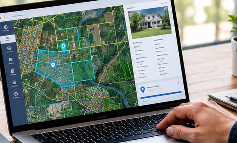
Granville County GIS makes property maps, parcels, zoning and local data easier to explore with confidence.
Granville County GIS is the county’s online mapping system for exploring parcels, property lines, addresses, zoning, districts, aerial imagery and other geographic information. The county says parcels are updated daily, streets and addresses are updated monthly, and its aerial photography is current as of 2025.
A property map can answer questions that a traditional property record cannot. Where exactly is the parcel? How large does it appear to be? What roads, jurisdictions, districts or zoning areas surround it?
That is where Granville County GIS becomes useful. The county’s GIS hub combines property and geographic information into an interactive map, giving homeowners, buyers, landowners, researchers and local professionals a visual way to investigate property and place.
The interesting part is that the map is more than a collection of property lines. Current county information includes zoning districts, municipal boundaries, school attendance zones, voting precincts, emergency-service locations and political districts, while historical aerial imagery can be used to compare how an area has changed over time.
Here is how to use it without falling into the most common trap: assuming that everything visible on a map is automatically a legally definitive property fact.
What You'll Discover:
What Is Granville County GIS?
A geographic information system, or GIS, connects information to locations on a map. Think of it as a digital filing cabinet where the folders are tied to places instead of sitting on a shelf.
For Granville County, the GIS department generates records using recorded deeds, plats and other public records. The county currently states that parcel information is updated daily, while streets and addresses are updated at the beginning of each month.
That distinction matters.
A GIS map is excellent for finding, visualizing and investigating information. It is not automatically a substitute for a recorded deed, plat, boundary survey or other authoritative legal document.
Granville County says its GIS parcels are updated daily, while streets and addresses are updated monthly.
What You Can Find on the Granville County GIS Map
The current county mapping application goes considerably beyond basic parcel outlines.
Property Lines and Parcels
The parcel layer is usually the first place people go. You can use it to locate an individual property and examine the geographic footprint associated with the county’s parcel records.
For someone researching land before making an offer, this creates a useful starting point: identify the parcel, inspect the surrounding properties, and then move to the underlying tax and land records for verification.
Zoning and Planning Information
The GIS application includes county zoning districts as well as municipal boundaries and planning or zoning jurisdictions.
That can be especially useful when researching vacant land. A parcel’s location can tell you which planning jurisdiction deserves your attention, but the map itself should not be treated as permission to build a particular structure.
Granville County’s Planning Division administers the county Land Development Ordinance and handles matters including zoning and watershed permits, subdivision plats, variances, rezoning and special-use applications.
Districts, Schools and Emergency Services
The county’s 2026 GIS resource announcement identifies several additional layers, including:
- County Commissioner districts
- Board of Education districts
- North Carolina General Assembly districts
- Congressional districts
- Granville County Public Schools attendance zones
- Voting precincts
- Fire department locations and response areas
- EMS stations
- Municipal boundaries
- Planning and zoning jurisdictions
These layers can turn a simple property search into a much broader location investigation.
For example, a family considering a home might examine school attendance boundaries and municipal jurisdiction. A business owner might be more interested in zoning and transportation-related geography. A landowner could investigate neighboring parcels and emergency-service coverage.
How to Search for a Property
The easiest approach depends on what information you already have.
If You Know the Address
Start with the property address and use the map to locate the corresponding parcel.
Once you have found it, don’t stop at the parcel outline. Review the surrounding roads, nearby parcels, jurisdictional boundaries and available map layers.
This is particularly useful when an address is formatted differently across records. A map can help you establish the geographic location before you start comparing tax or deed records.
If You Know the Owner
An owner’s name can be useful when working through Granville County’s tax records. The county’s online tax system supports searches using an owner’s last name, first and middle name, parcel number, alternate parcel identifier, tax year, bill number and property address.
A practical workflow is to use the tax system to identify the property record, then use GIS to understand where that property sits geographically.
If You Know the Parcel Number
A parcel identifier is often the cleanest bridge between mapping and tax information.
Use the parcel number to locate the associated property record, then compare the mapped parcel with the tax information. If something seems inconsistent, investigate the underlying public records rather than assuming the map is wrong—or assuming the map is right.
GIS vs. Tax Records vs. Deeds
These resources overlap, but they answer different questions.
| Resource | Best for | What it tells you | What it should not replace |
| Granville County GIS | Location and visual research | Parcels, map layers, imagery, jurisdictions | A boundary survey or legal instrument |
| Tax property search | Assessment and billing research | Tax records, parcel-related information and billing data | Legal title research |
| Register of Deeds | Recorded land documents | Deeds, plats, deeds of trust and other recorded instruments | A GIS map |
| Planning & Zoning | Development questions | Zoning, subdivision and land-use processes | Independent assumptions based on a map |
This separation is one of the most important things to understand.
Granville County’s Register of Deeds records and indexes real-estate documents including deeds, deeds of trust and plats, with deeds available dating back to 1746. The county says those documents are available online and copies can be requested.
So if the question is “Where is this parcel?”, GIS is a logical starting point.
If the question is “What does the recorded deed or plat establish?”, move to the Register of Deeds.
If the question is “What is the county’s assessed value?”, use the tax records.
And if the question is “Can I develop this property in a particular way?”, talk to Planning & Zoning.
How Current Is Granville County GIS?
Currency is one of the most useful details to know before relying on any public mapping system.
Granville County currently states that parcel data is updated daily, streets and addresses are updated at the beginning of each month, and aerial photography is current as of 2025.
The county also announced in August 2026 that its mapping application contains historical satellite imagery dating back to 2005. That creates a surprisingly useful way to examine changes across roughly two decades.
Historical imagery can help answer questions such as whether a road, structure or cleared area existed years ago.
It still does not prove a property’s legal history by itself.
What Granville County GIS Does Not Prove
This is where online property maps can become misleading.
A visible line on a GIS map should not automatically be interpreted as the exact legal boundary of a property. North Carolina’s statewide parcel-data documentation explicitly describes parcel data as an inventory of county tax parcels and says it is not a survey document. It advises users to consult the authoritative county data steward when authoritative source information is needed.
That warning matters most when money or legal rights are involved.
Suppose a GIS boundary appears to put a fence several feet inside a parcel. That does not, by itself, establish an encroachment. A survey and the relevant recorded documents may be necessary to determine the actual boundary.
Likewise, an aerial photograph showing a driveway does not automatically establish an easement, and a zoning layer does not independently establish every development right attached to a property.
A GIS parcel map is a research tool, not a substitute for a land survey.
Using GIS When Buying Land
GIS can be especially helpful during property due diligence because it lets you ask better questions before spending money on deeper research.
Imagine you are considering a rural parcel in Granville County. The first pass might involve locating the property, examining neighboring parcels, checking road access visually and reviewing zoning-related layers.
Next, move from the map to the records.
Check the tax record, review recorded deeds and plats, investigate applicable development rules, and obtain professional advice where boundaries, access, septic suitability or other site-specific issues matter.
The map is the starting point of the investigation, not the investigation itself.
Using GIS for Property Taxes
Granville County’s tax information is closely connected to property research, but GIS and taxation serve different purposes.
The county’s current revaluation information says the effective date of its current countywide real-estate valuation is January 1, 2024. Granville County moved to a six-year revaluation cycle, and the county identifies 2030 as the next scheduled countywide revaluation.
The county also provides downloadable real-property data, including account, building, land, parcel, permit and sales files. The currently listed downloadable tax data was updated in May 2026, while the county notes that these files are static and periodically updated.
That makes the downloadable datasets useful for researchers, analysts and property professionals who need to work with many records rather than inspect one parcel at a time.
A Simple Granville County Property Research Workflow
For a typical property investigation, this sequence keeps things organized:
- Locate the property in GIS.
- Confirm the address and parcel identifier.
- Inspect neighboring parcels and relevant map layers.
- Check the county tax record.
- Review recorded deeds and plats when ownership or boundaries matter.
- Check Planning & Zoning for land-use questions.
- Use a licensed surveyor when an exact boundary determination is required.
The power of GIS comes from combining these steps rather than expecting one website to answer every question.
When to Contact Granville County
Online research has a natural stopping point.
For GIS-specific questions, Granville County lists the GIS department at 919-692-1278.
For land-use and zoning questions, the Planning Division lists 919-603-1326.
For recorded real-estate documents, the Register of Deeds lists 919-693-6314.
And if the information you need is not available through the county’s online resources, Granville County provides a public-records request process.
Frequently Asked Questions
Is Granville County GIS free to use?
The county provides public access to its GIS mapping application through its official GIS hub. The county also provides online tax and public-record resources, although certain requested records or copies may involve fees.
How often are Granville County GIS parcels updated?
Granville County states that parcels are updated daily. Streets and addresses are updated at the beginning of each month.
Can I use Granville County GIS to determine my exact property boundary?
Not as a substitute for a survey. North Carolina’s statewide parcel-data documentation specifically says parcel data is not a survey document and recommends consulting authoritative county sources for verification.
Can I see historical imagery?
Yes. Granville County announced in 2026 that its mapping application includes satellite imagery dating back to 2005.
Where can I find deeds and plats?
Granville County’s Register of Deeds records and indexes deeds, deeds of trust, plats and other real-estate documents. The county says deeds date back to 1746 and documents are available online, with copies available upon request.
Key Takeaways
- Granville County GIS is the county’s interactive geographic information resource for property and location research.
- Parcel information is currently reported by the county as updated daily; streets and addresses are updated monthly.
- The map includes more than parcels, including zoning, school attendance zones, voting precincts, emergency services and jurisdictional boundaries.
- Historical imagery reaches back to 2005, making it useful for examining changes over time.
- GIS parcel lines should not be treated as a legal survey boundary.
- Use the Tax Administration system for assessment and billing information and the Register of Deeds for recorded land documents.
- For development questions, verify the relevant rules with Granville County Planning & Zoning rather than relying solely on map layers.
Additional Resources
- Granville County Register of Deeds: Useful for researching recorded deeds, plats, deeds of trust and other permanent real-estate documents.