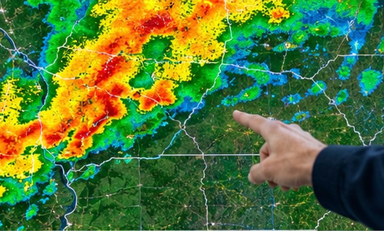
Charleston WV weather radar made it simple, tracking rain, storms, snow, and flooding with confidence before heading out.
The Charleston WV weather radar is centered on the National Weather Service’s KRLX radar and is designed to show where precipitation is occurring and how it is moving. For the most useful picture, combine radar with the National Weather Service forecast, warnings, and local observations rather than treating a radar image as a stand-alone forecast.
What You'll Discover:
Why Charleston WV Weather Radar Is Worth Checking
A forecast might tell you that rain is likely in Charleston, but radar answers a more immediate question: Where is the rain right now, and is it moving toward me?
That distinction matters in the Charleston area because a forecast covering several hours can hide major local differences. One neighborhood may be dry while a narrow band of heavy rain is crossing another part of Kanawha County.
The National Weather Service office serving Charleston provides local radar, regional radar, satellite imagery, observations, rainfall information, warnings, and forecasts in one place.
Radar shows what is happening in the atmosphere now; a forecast estimates what is likely to happen next.
That makes radar particularly useful before commuting, driving through the region, planning outdoor activities, or deciding whether a storm is actually approaching your location.
Charleston WV Weather Radar: What You Are Actually Seeing
The Charleston-area radar is part of the U.S. NEXRAD network, using a WSR-88D weather radar. NEXRAD radars scan the atmosphere at multiple elevation angles, building a three-dimensional picture of precipitation and storm structure.
The basic radar display is called reflectivity. Instead of directly measuring rainfall at every spot on the ground, the radar measures energy returned from objects in the atmosphere, including raindrops, snowflakes, hail, and sometimes non-weather objects.
Reflectivity is expressed in dBZ, or decibels of Z. Higher dBZ generally means stronger radar returns and often heavier precipitation, although the relationship is not as simple as “red equals dangerous.”
What the radar colors mean
A typical precipitation display progresses from weak returns to increasingly strong returns. Exact colors vary between radar websites, so the numerical dBZ scale is more useful than memorizing colors.
| Approximate dBZ | What it can indicate |
| 20–30 | Light precipitation or a trace |
| 30–40 | Moderate precipitation |
| 40–50 | Heavy precipitation becoming more likely |
| 50–60 | Very heavy precipitation or strong storm cores |
| 60+ | Extremely strong returns; hail may also be possible |
These values should be treated as radar reflectivity, not guaranteed rainfall rates. For example, the National Weather Service notes that rainfall-rate estimates depend on precipitation type and other factors, while hail can produce unusually strong returns.
A bright radar return does not automatically mean severe weather.
A storm can produce intense rain without meeting severe-weather criteria, while a dangerous storm may sometimes have a radar appearance that is less dramatic than expected.
How to Read Charleston Radar in Under a Minute
The fastest useful method is to look for location, movement, intensity, and warnings.
1. Find Charleston first
Start by locating Charleston, South Charleston, Kanawha County, and nearby landmarks or highways. This gives you a reference point for judging whether precipitation is approaching or moving away.
If the radar shows a line of storms west of Charleston, for example, the next question is not simply “Is it raining?” It is “Is that line moving toward Charleston, and how quickly?”
2. Watch the loop, not one frame
A single radar image is essentially a photograph. A radar loop is a short movie.
Movement becomes much easier to understand when several scans are played consecutively. You can see whether a storm is strengthening, weakening, splitting, merging, or changing direction.
This is one of the biggest mistakes beginners make: staring at one radar frame and trying to predict the future from it.
3. Look at the storm’s direction
Imagine a line of heavy returns moving northeast toward Charleston. If the line remains organized through several radar frames, the probability of continued precipitation in its path becomes more meaningful than the appearance of any single frame.
For short-term decisions, motion often tells you more than color alone.
4. Check official warnings separately
Radar does not replace warnings.
The NWS Charleston office publishes watches, warnings, advisories, hazardous-weather information, and severe-weather resources alongside its radar products.
If you see an intense storm approaching, check the official warning information rather than relying solely on the radar image.
Why Charleston Radar Can Sometimes Look Strange
Weather radar is powerful, but it is not a camera pointed directly at the ground.
The radar beam rises with distance because of the Earth’s curvature and atmospheric effects. At longer distances, the beam can therefore sample precipitation higher above the surface rather than precipitation immediately over your neighborhood. NOAA identifies limited low-level coverage as a significant characteristic of the NEXRAD network.
Terrain can matter too. Charleston sits within the Appalachian region, where hills and changing elevation can complicate radar interpretation.
NOAA also notes that radar precipitation estimates can be affected by beam blockage, beam-filling problems, attenuation, distant targets, and other factors.
That explains an occasionally confusing situation: you can be getting wet while the radar appears to show little precipitation directly overhead.
Radar is an estimate, not a rain gauge
Radar estimates should be interpreted alongside ground observations.
The NWS Charleston office provides local observations, rain-gauge monitoring, snowfall reports, and storm reports in addition to radar.
For flooding or rainfall totals, this combination is especially valuable. A radar-derived rainfall estimate can show where precipitation has been concentrated, while gauges provide measurements from the surface.
Local Radar vs. Regional Radar
Charleston’s local radar is not the only useful source when watching a storm.
The NWS provides local KRLX radar as well as regional and national radar options.
| Radar view | Best use |
| Local KRLX radar | Watching storms around Charleston |
| Regional radar | Understanding larger storm systems |
| National radar | Tracking systems across multiple states |
| Satellite | Seeing cloud structure and broader weather patterns |
| Surface observations | Confirming conditions at the ground |
Regional radar becomes particularly useful when a storm is approaching from outside the immediate Charleston area. You can zoom out first, understand the larger system, then return to the local view for detail.
What to Check Before Driving in Charleston
Radar becomes much more practical when you connect it to a specific decision.
Before leaving, look at the radar loop and ask:
- Is precipitation moving toward my route?
- Is the heaviest precipitation directly along the route or nearby?
- Are thunderstorms embedded within the rain?
- Are there active watches or warnings?
- Could heavy rainfall create flooding concerns?
- Does the official forecast support what the radar appears to show?
For example, suppose you are driving from Charleston toward the surrounding communities and see a narrow, intense line moving across the region. The useful question is not whether the map looks dramatic. It is whether that line intersects your route during your expected travel time.
That is the difference between looking at weather radar and actually using it.
Rain Radar vs. Thunderstorm Radar
Radar can help identify areas of precipitation, but precipitation intensity alone does not establish whether a storm is severe.
A thunderstorm may contain strong winds, hail, frequent lightning, or other hazards that require additional information. The NWS severe-weather resources combine radar with warnings, storm reports, satellite information, and other observations.
When thunderstorms are nearby, pay particular attention to official warnings rather than attempting to diagnose storm severity solely from colors on a radar map.
Radar is best for tracking; warnings are best for action.
Snow and Winter Weather on Charleston Radar
Radar can also be useful during winter weather, but snow is harder to interpret than rain.
The radar return depends on the size, shape, density, and type of particles in the atmosphere. Mixed precipitation can create complicated radar signatures, and radar algorithms can have limitations in situations involving freezing temperatures and mountainous terrain.
For a winter-weather decision, combine radar with the NWS forecast, surface temperature, road conditions, and winter-weather alerts.
This is especially important around the transition between rain, sleet, freezing rain, and snow, when what radar detects aloft may not perfectly represent what reaches the pavement.
Charleston’s Climate Makes Radar Useful Year-Round
Radar is not only a summer thunderstorm tool.
NOAA climate records for Charleston use 1991–2020 as the current standard normal period, while the station’s longer record extends back to 1901. The National Weather Service maintains Charleston climate reports and historical records for temperature and precipitation.
Charleston’s weather changes substantially through the year, so the radar questions change with the season.
In summer, you may be watching for thunderstorms and intense rainfall. In winter, the important question can become whether precipitation is arriving as rain, snow, sleet, or freezing rain.
During spring and fall, rapidly changing storm systems can make radar particularly useful for seeing what is actually approaching rather than relying only on an earlier forecast.
What Charleston Radar Cannot Tell You
One of the most useful radar lessons is knowing its limits.
Radar cannot guarantee exactly when rain will begin at your house. It also cannot tell you with certainty how much rain a particular street will receive, whether every thunderstorm will become severe, or exactly what conditions will exist several hours later.
NOAA explains that precipitation estimates can be affected by radar geometry, blockage, attenuation, precipitation type, and whether the radar beam adequately samples the target.
So if radar, a forecast, and an observation appear to disagree, don’t automatically assume one is “wrong.” They may simply be measuring different parts of the weather system.
A Simple Charleston Weather Radar Decision Guide
| What you want to know | Best information to check |
| Is rain nearby? | Local radar |
| Is rain moving toward Charleston? | Radar loop |
| How intense is the precipitation? | Reflectivity/dBZ |
| Is dangerous weather officially occurring? | NWS warnings |
| What is happening at ground level? | Surface observations |
| How much rain has fallen? | Rain gauges + radar estimates |
| What happens over the next several hours? | Official forecast |
| What is the larger storm system doing? | Regional radar + satellite |
The most reliable approach is therefore not to choose one weather product and ignore everything else. Use radar for situational awareness, forecasts for what comes next, and warnings for urgent hazards.
Frequently Asked Questions
What radar covers Charleston, WV?
The Charleston area is served by the National Weather Service’s KRLX WSR-88D radar. The NWS Charleston office also provides regional and national radar views when broader coverage is useful.
What do red and yellow colors mean on Charleston weather radar?
They generally represent stronger radar reflectivity than green or blue areas, but color schemes vary between services. The numerical dBZ scale provides a more consistent way to interpret radar intensity.
Can weather radar predict rain?
Radar primarily shows detected precipitation and its movement. It can help with short-term tracking, but it should be combined with forecasts for future conditions.
Why is it raining when Charleston radar looks clear?
Radar can miss or underestimate precipitation because of beam height, terrain, blockage, attenuation, and other technical limitations. Ground observations and rain gauges can help confirm what is actually happening at the surface.
Is radar enough to determine whether a storm is dangerous?
No. Radar is an important tool, but official watches, warnings, storm reports, observations, and forecasts provide additional information needed to assess weather hazards.
Key Takeaways
- Charleston WV weather radar uses the KRLX NEXRAD radar to monitor precipitation and storm activity around the region.
- Watch a radar loop, not just a single image, to understand storm movement.
- dBZ measures radar reflectivity; stronger returns generally indicate stronger precipitation, but they do not automatically mean severe weather.
- Radar can occasionally underestimate or miss precipitation because of beam geometry, terrain, blockage, and other limitations.
- Use official NWS warnings when thunderstorms or other hazards are nearby.
- For the clearest picture, combine radar with forecasts, satellite imagery, surface observations, and rainfall measurements.
- Before driving, focus on whether the storm’s movement intersects your route, rather than simply asking whether the radar looks bad.
Additional Resources
- NWS Charleston, WV: Provides official forecasts, warnings, radar, observations, satellite imagery, climate information, and local weather hazards for the Charleston area.