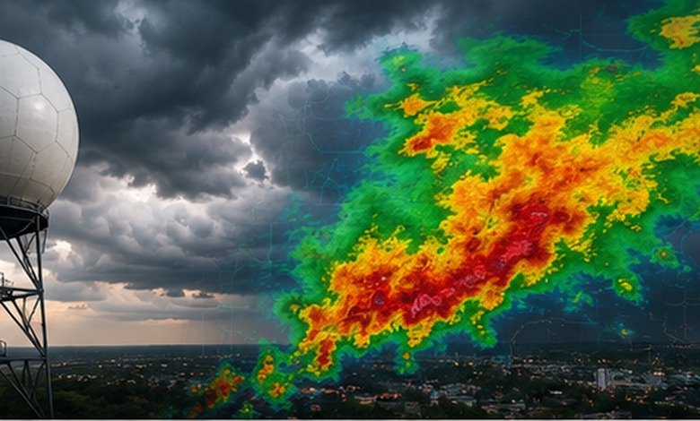
Ithaca weather radar made simple: track rain, snow and storms with confidence before heading outside.
The best place to check Ithaca weather radar is the National Weather Service radar network, which provides live radar imagery alongside forecasts and weather alerts. Ithaca is served by the NWS Binghamton forecast office, and its radar resources can show where precipitation is now, how it is moving, and whether nearby weather may become hazardous.
What You'll Discover:
Why Ithaca Weather Radar Matters
A weather forecast might tell you that rain is likely today. Radar answers the question that often matters more: Is the rain actually coming toward me, and when?
That distinction is especially useful in Ithaca, where a forecast covering an entire day can hide a very different reality for someone walking across Cornell’s campus, driving through Tompkins County, or planning an outdoor event around Cayuga Lake.
Radar provides a near-real-time picture of precipitation rather than simply describing what atmospheric models expect. The National Weather Service’s radar system combines radar observations with forecasts and alerts, making it useful as part of a broader weather-checking routine.
Radar shows what the atmosphere is doing; a forecast helps explain what it is likely to do next.
That difference is the key to using an Ithaca radar map intelligently.
Where to Check Ithaca Weather Radar
The most authoritative starting point is the National Weather Service radar, particularly the resources provided by the NWS Binghamton office. Its coverage area includes Ithaca and other communities across central New York and northeastern Pennsylvania.
The NWS radar site offers several useful views, including individual radar-station products and a national radar mosaic. It also has a location-based view that combines radar, current conditions, alerts and forecasts.
For a local forecast, the NWS also provides an Ithaca point forecast using observations from Ithaca Tompkins International Airport and the surrounding forecast area.
Commercial weather services can be useful as secondary tools. For example, Weather Underground provides radar alongside observations from the Ithaca area, while AccuWeather offers precipitation-type radar maps.
Which Radar Source Should You Trust?
| Source | Best for | Main advantage |
| National Weather Service | Storms, warnings, official radar | Authoritative alerts and radar data |
| Weather Underground | Local conditions | Dense network of weather stations |
| AccuWeather | Easy-to-use precipitation maps | Simple consumer interface |
| Radar + NWS forecast together | Decision-making | Combines observation with prediction |
The important point is not to treat one colorful radar map as the entire weather story. Radar, forecasts, warnings, observations and satellite imagery answer slightly different questions.
How to Read an Ithaca Radar Map
At first glance, radar can look like a rainbow spilled across New York. Fortunately, you only need to understand a few concepts to make sense of it.
Green, Yellow and Red Don’t Mean the Same Thing as a Forecast
Radar reflectivity measures the energy returned to the radar by targets such as raindrops, snowflakes and hail.
In general, stronger reflectivity corresponds to more intense precipitation, although the relationship isn’t perfectly one-to-one. Large drops, hail and concentrated precipitation can all produce strong returns.
A useful rule of thumb is:
- Weak echoes: often light precipitation
- Moderate echoes: heavier rain or snow
- Strong echoes: potentially intense precipitation
- Very strong, compact echoes: worth investigating for thunderstorms or hail
A bright radar return does not automatically mean a tornado. Radar intensity and severe-weather threat are related but different questions.
Watch the Animation, Not Just One Frame
A single radar image tells you where precipitation is. An animated loop tells you where it is going.
Suppose a band of rain is 30 miles west of Ithaca. If several frames show it moving steadily east, that is much more useful than simply knowing that rain exists west of the city.
Look for three things:
- Direction: Is the precipitation moving toward Ithaca?
- Speed: How quickly is the leading edge approaching?
- Organization: Is the precipitation weakening, strengthening or becoming more concentrated?
This is why radar animation can be surprisingly valuable for deciding whether to leave for a hike now or wait an hour.
What Ithaca Radar Can and Cannot Tell You
Radar is powerful, but it isn’t a crystal ball.
The NWS explains that radar reflectivity provides a picture of returned energy, while velocity measures movement toward or away from the radar. Importantly, velocity is radial: it does not directly show every component of wind motion.
Radar coverage also has physical limitations. As a radar beam travels farther from its antenna, it generally samples the atmosphere at greater height, while terrain and atmospheric conditions can affect what the radar detects.
That creates a common misconception: “If radar isn’t showing rain directly over me, it can’t be raining.”
Not necessarily.
Light precipitation can be difficult to detect, precipitation can evaporate before reaching the ground, and the radar beam may be sampling higher above the surface at longer distances.
For Ithaca, this matters when interpreting small or weak precipitation areas. Radar is best used alongside an observation from a nearby station and the official forecast.
Why Dual-Polarization Makes Modern Radar More Useful
Modern NWS radar isn’t simply measuring whether something is bright or dark on a screen.
Dual-polarization technology sends and receives radar energy in both horizontal and vertical orientations. That additional information helps forecasters estimate the size, shape and composition of particles and improve precipitation estimates.
It can help distinguish among rain, snow, hail and other targets, while also improving detection of non-weather echoes.
For someone checking Ithaca weather radar during a winter storm, that matters. A precipitation blob isn’t necessarily just “snow”; radar products can provide additional clues about precipitation type and the location of the melting layer.
Modern dual-polarization radar helps meteorologists distinguish precipitation types that a basic radar image cannot reliably separate.
Using Radar for Real-Life Ithaca Decisions
The best radar habit is to connect what you see on the screen to a specific decision.
Before Driving
Check the radar loop rather than relying solely on the daily precipitation percentage.
If a narrow but intense band is moving toward Ithaca, the practical question isn’t whether rain is forecast “today.” It’s whether the band is likely to reach your route during your departure window.
For longer trips, zoom out. A storm that looks small over Ithaca may be part of a much larger line extending across central New York.
Before an Outdoor Event
For a concert, sporting event, hike or campus activity, check radar roughly 30–60 minutes before leaving and again shortly before the activity begins.
Don’t stop at reflectivity. Look at the NWS alerts and forecast discussion when thunderstorms are involved. Cornell’s emergency-management resources specifically direct the university community toward NWS radar and other weather resources for local monitoring.
During Thunderstorms
Radar becomes more important when weather is changing quickly, but safety decisions should come from official warnings rather than trying to diagnose a storm yourself.
If the NWS issues a warning for your area, treat that warning as the primary safety signal. Radar can help you understand the storm’s position and movement; it should not replace an official warning.
Ithaca Rain, Snow and Seasonal Radar Clues
Ithaca’s weather changes considerably through the year, which changes how useful different radar signals can be.
NOAA’s 1991–2020 climate normals for the Ithaca Cornell University station show about 38.29 inches of annual precipitation, with precipitation occurring throughout the year rather than being concentrated in one season.
That year-round precipitation makes radar useful in every season, but winter introduces an extra challenge: precipitation type.
A winter radar map may show precipitation over the region without making the ground-level situation obvious. Temperature, elevation and the vertical structure of the atmosphere determine whether that precipitation reaches Ithaca as snow, sleet, freezing rain or ordinary rain.
This is one reason radar should be paired with the NWS forecast rather than interpreted in isolation.
A Simple 60-Second Radar Routine
If you don’t want to become a meteorologist, use this quick routine.
Step 1: Center the Map on Ithaca
Start close enough to see Ithaca and Tompkins County clearly.
Step 2: Turn on the Radar Loop
Watch several frames instead of relying on the latest image.
Step 3: Identify the Direction
Ask whether precipitation is moving toward Ithaca, away from it or around it.
Step 4: Check Intensity
Look for areas of strengthening reflectivity, particularly compact intense cells.
Step 5: Check Official Alerts
Open the NWS forecast and active watches or warnings before making decisions about severe weather.
Step 6: Compare With Ground Observations
If the radar appears inconsistent with what is happening outside, remember that radar is sampling the atmosphere remotely. A nearby observation can provide valuable context.
Common Ithaca Radar Mistakes
Mistake 1: Assuming Red Means Tornado
Red generally indicates stronger radar reflectivity. It does not independently prove that a tornado exists.
Mistake 2: Looking Only at the Latest Image
Movement is often more informative than position. Always use the loop when timing matters.
Mistake 3: Confusing Radar With a Forecast
Radar primarily describes observed precipitation and its movement. Forecast models and meteorologists are responsible for the prediction component.
Mistake 4: Ignoring the Radar’s Location
Velocity data is interpreted relative to the radar site. NWS guidance specifically notes that understanding the radar’s location is essential when interpreting velocity imagery.
Mistake 5: Treating Every Echo as Weather
Radar can detect non-meteorological targets, including biological objects and other sources of interference. Modern dual-polarization products help forecasters identify some of these returns.
FAQ
What is the best Ithaca weather radar?
The National Weather Service radar is the best authoritative starting point for Ithaca. The NWS Binghamton office provides radar and forecast resources for Ithaca and surrounding counties.
How accurate is Ithaca weather radar?
Radar is highly useful for locating and tracking precipitation, but it has limitations involving beam height, terrain, attenuation and weak or distant echoes. It should be interpreted alongside observations and official forecasts.
What do radar colors mean?
Radar colors represent different levels of returned energy, commonly associated with precipitation intensity. Stronger colors generally indicate stronger echoes, but they do not by themselves identify tornadoes or other specific hazards.
Can radar tell if Ithaca will get rain?
Radar can show whether precipitation is approaching and how it is moving, but predicting whether it will reach the ground at a particular location requires additional forecast information.
Does radar show snow?
Yes. Radar can detect snow and other forms of precipitation, and dual-polarization products provide additional information that helps meteorologists distinguish precipitation types.
Key Takeaways
- Ithaca weather radar is most useful when you watch the movement of precipitation rather than a single radar frame.
- The National Weather Service is the strongest authoritative source for Ithaca radar, warnings and forecasts.
- Radar reflectivity shows returned energy associated with precipitation; stronger echoes generally indicate more intense precipitation.
- Radar cannot independently tell you whether a storm will produce a tornado or exactly what conditions exist at ground level.
- Dual-polarization radar provides additional information about precipitation size, shape and type.
- Ithaca receives precipitation throughout the year, making radar useful in every season. NOAA’s 1991–2020 normals record about 38.29 inches of annual precipitation at the Ithaca Cornell University station.
- For important decisions, use radar + official warnings + the local forecast + ground observations, rather than relying on any single screen.
Additional Resources
- National Weather Service Radar: A primary source for radar imagery, precipitation movement, location-based weather information and official weather alerts.