Weather radar Kalamazoo made simple: track storms, rain and snow with confidence before heading outside.
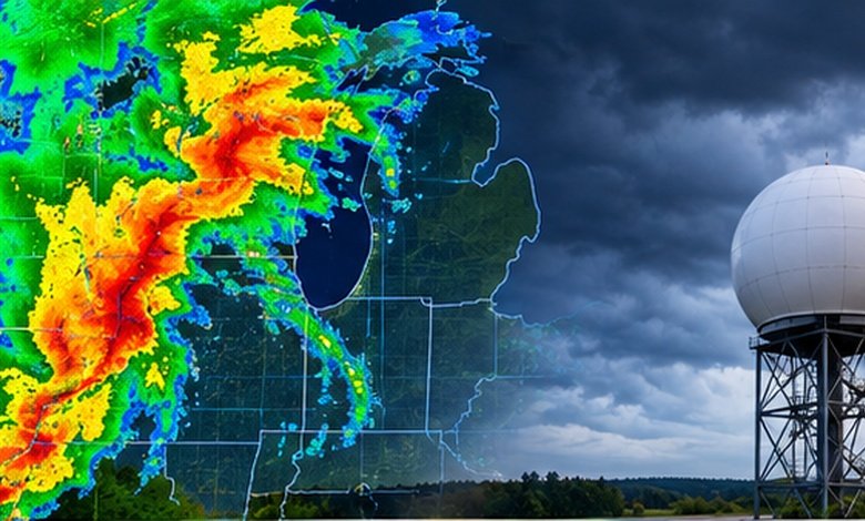
For weather radar Kalamazoo, the official National Weather Service radar for the area is associated with KGRR, the Grand Rapids NEXRAD site, operated by the NWS Grand Rapids office. The radar shows precipitation intensity and movement, while velocity and dual-polarization products provide additional clues about wind, storm structure, hail and precipitation type.
The important catch: radar is an observation tool, not a crystal ball. A radar loop is excellent for answering “Where is the rain or storm going?”, but forecasts and warnings are still needed to understand what may develop next.
What You'll Discover:
Why Kalamazoo Radar Is More Useful Than a Static Forecast
A forecast might tell you that thunderstorms are possible this afternoon. Radar answers the much more practical question: Is that storm actually moving toward me right now?
That distinction matters in Kalamazoo because weather can vary sharply across southwest Michigan. A storm producing heavy rain west of the city may weaken before reaching downtown, while another cell can intensify along its route.
The National Weather Service’s Grand Rapids office provides the official forecast and radar information for Kalamazoo County. Its weather.gov pages include local radar, forecasts, warnings and observations in one place.
Radar is most valuable when the weather is already changing. A forecast tells you what meteorologists expect; radar shows you what the atmosphere is actually doing.
For the official map, use the National Weather Service radar display and select the Kalamazoo area or the KGRR radar.
How Weather Radar Works Around Kalamazoo
Weather radar sends pulses of radio energy into the atmosphere and measures energy that returns after encountering objects such as raindrops, snowflakes or hail. The timing of the returned signal helps determine distance, while the strength and characteristics of the return provide information about the precipitation.
Kalamazoo’s primary local NEXRAD reference is KGRR, the Grand Rapids radar. The station is located in Kent County, north of Kalamazoo, so the radar is looking at precipitation from a regional perspective rather than directly from inside the city.
That geography is worth remembering.
As the radar beam travels farther from the antenna, it generally samples higher portions of the atmosphere. This means a return can sometimes look weaker—or disappear—even though precipitation is occurring closer to the ground. NWS documentation specifically identifies partial beam filling and overshooting as limitations of radar precipitation measurements.
A clean radar screen does not always mean dry weather at street level.
That is particularly important during shallow winter precipitation and when interpreting radar near the edge of a radar’s useful coverage.
What the Radar Colors Actually Mean
Most people first look at the colors. That’s useful, but colors are only a visual shorthand for reflectivity, commonly expressed in dBZ.
Higher reflectivity generally indicates stronger radar returns, often associated with heavier precipitation. But it does not mean that every bright-colored area is automatically dangerous. Hail, melting snow and other targets can produce unusually strong returns.
A simplified way to think about the display is:
| Radar feature | What it tells you | What to remember |
| Weak returns | Light precipitation or weak echoes | May be drizzle, light rain or snow |
| Moderate returns | More substantial precipitation | Check the motion and duration |
| Strong returns | Heavy precipitation or intense storm cores | Hail can exaggerate reflectivity |
| Very strong returns | Potentially intense precipitation or hail | Don’t judge severity from color alone |
| Velocity | Motion toward/away from radar | Useful for wind and storm structure |
| Composite reflectivity | Strongest return through the scanned volume | Can highlight higher-altitude echoes |
| Base reflectivity | Return from a specific low-level scan | Often more useful for seeing what’s near the surface |
NWS explains that base reflectivity uses a single elevation scan, while composite reflectivity displays the strongest return from the radar’s various elevation scans.
So if composite reflectivity looks dramatic but the base-reflectivity image is much weaker, don’t assume the storm is necessarily dumping extreme rain at ground level.
How to Read a Kalamazoo Radar Loop
A single radar image tells you where precipitation is. A loop tells you what it is doing.
Start by watching the last 30–60 minutes of movement. Look for three things: direction, speed and intensity.
If a rain area moves steadily eastward and Kalamazoo sits directly ahead of it, you have a reasonable short-term indication that rain is approaching. If the echoes are weakening as they move, however, simply extending their current path may overstate what will happen.
This is why radar should be treated more like watching traffic than reading a timetable. You can see a car moving toward an intersection, but you cannot assume it will maintain exactly the same speed or even continue on the same route.
NWS nowcasting research notes that short-term precipitation forecasts can extrapolate current radar movement, but storm growth and decay introduce uncertainty—especially with convective storms.
Use the Loop to Estimate Arrival Time
Suppose a storm is approaching from the west.
Rather than staring at the latest frame, rewind the loop and compare where the storm was 10, 20 and 30 minutes ago. Estimate its direction and pace, then compare that path with your location.
This gives you a rough nowcast, not a guaranteed arrival time.
If the storm suddenly develops new cells ahead of its previous path, the estimated arrival can change quickly. That’s one reason a radar loop is more useful than a single screenshot.
What Velocity Radar Adds
Reflectivity tells you about returned energy. Velocity tells you about motion relative to the radar.
Doppler radar measures the component of movement directly toward or away from the radar. On standard displays, green commonly represents motion toward the radar and red represents motion away from it.
For an everyday user, velocity becomes particularly interesting when thunderstorms are nearby.
Meteorologists can examine velocity patterns alongside reflectivity to investigate strong winds and rotation. But a patch of red and green on a phone screen is not by itself proof of a tornado. Storm structure has to be interpreted in context, which is one reason official warnings matter.
If severe weather is occurring, don’t wait for yourself to diagnose a radar signature before taking action.
Why Dual-Polarization Radar Matters in Michigan
Modern NEXRAD systems use dual-polarization, which sends radar energy in horizontal and vertical orientations. Comparing those returns gives forecasters additional information about the size, shape and composition of particles in the atmosphere.
That helps distinguish precipitation types and identify non-weather echoes. It can also improve precipitation estimates and help forecasters recognize hail and other storm characteristics.
This becomes especially useful in Kalamazoo during mixed winter precipitation.
A winter radar image may show a broad area of precipitation, but the crucial question is whether that precipitation reaches the ground as snow, sleet, freezing rain or ordinary rain. Radar classification is one piece of that puzzle; surface temperature, atmospheric profiles and observations remain important too.
Kalamazoo Radar and Lake-Effect Snow
Southwest Michigan’s proximity to Lake Michigan gives winter radar a particularly local character.
When cold air crosses the relatively warmer lake, it can acquire heat and moisture and help produce lake-effect snow. The resulting snow bands can be narrow, intense and unevenly distributed.
That creates a classic radar situation: one community can be experiencing heavy snow while another nearby location has considerably less.
A recent NWS briefing illustrates how lake-effect snow can produce highly localized snowfall potential across the Lower Peninsula, including Kalamazoo.
For drivers, the practical lesson is simple: don’t judge road conditions several miles away by looking at your own window.
Watch the radar position of the snow band, then compare it with observations and road conditions. Radar can show where the band is moving, but it cannot directly tell you whether pavement is icy or whether visibility has fallen to dangerous levels.
Common Kalamazoo Radar Mistakes
Mistake 1: Assuming every colored echo is rain
Radar detects reflected energy, not “rain” in the everyday sense. Birds, insects, ground clutter, hail and other non-precipitation targets can produce echoes.
Mistake 2: Treating the color scale as a danger scale
A stronger return often means heavier precipitation, but intensity and hazard aren’t identical. A strong hail core, for example, can produce a powerful radar return while distorting rainfall estimates.
Mistake 3: Looking at only one frame
One image shows location. A loop shows movement.
Mistake 4: Assuming radar is a long-range forecast
Radar is strongest for current and very short-term precipitation tracking. Beyond that, storm development, dissipation and changes in atmospheric conditions can make simple extrapolation increasingly unreliable.
Mistake 5: Ignoring official warnings
A radar app can show a frightening-looking storm, but an official warning provides the critical information about the hazard, affected area and recommended action.
Radar vs. Forecast vs. Warning
These tools answer different questions.
| Tool | Main question | Best use |
| Radar | What’s happening now? | Track precipitation and storm movement |
| Radar loop | Where is it going? | Estimate short-term movement |
| Hourly forecast | What conditions are expected? | Plan the next several hours |
| Forecast discussion | Why is the weather changing? | Understand uncertainty and storm evolution |
| Watch | Could hazardous weather develop? | Prepare and stay alert |
| Warning | Is hazardous weather occurring or imminent? | Take protective action |
The mistake is choosing one tool and expecting it to do all six jobs.
For example, if you are deciding whether to walk across Kalamazoo during an afternoon storm, radar is useful. If you’re deciding whether to schedule an outdoor event three days from now, the forecast is much more relevant.
A Simple 3-Minute Radar Routine
When weather looks questionable, use this sequence:
- Check the official warning map. See whether Kalamazoo County is under a watch or warning.
- Open the radar loop. Don’t rely on the latest frame alone.
- Identify storm direction. Notice whether precipitation is moving toward or away from your location.
- Check intensity. Look for strengthening or weakening echoes.
- Compare radar with observations. Airport and surface observations provide useful ground-level confirmation.
- Check the forecast discussion if the situation is complicated. It can explain expected storm development that a radar image cannot.
- During severe weather, follow official warnings rather than trying to interpret the storm yourself.
The NWS Grand Rapids site provides local radar, observations, forecasts and hazardous-weather information for the region.
Frequently Asked Questions
What radar covers Kalamazoo, Michigan?
The National Weather Service Grand Rapids office uses the KGRR NEXRAD radar as its local radar resource for southwest Michigan, including Kalamazoo. KGRR is located in Kent County, north of Kalamazoo.
What does dBZ mean on Kalamazoo weather radar?
dBZ means decibels of Z, a logarithmic measure related to radar reflectivity. Higher values generally correspond to stronger returned energy and often heavier precipitation, although hail and other factors can produce unusually strong returns.
Can radar tell me exactly when rain will start in Kalamazoo?
Not exactly. Radar loops can support short-term estimates by showing storm movement, but precipitation can strengthen, weaken, split or develop in new locations. Short-term extrapolation becomes less reliable as the forecast period increases.
Why can it be snowing in Kalamazoo when radar looks weak?
Radar samples the atmosphere above the surface, and the radar beam generally becomes higher with distance. Shallow precipitation can therefore be difficult to detect accurately, while beam geometry and precipitation type can also affect radar estimates.
Key Takeaways
- Weather radar Kalamazoo is most useful for tracking precipitation that is already developing or moving through southwest Michigan.
- KGRR is the local NEXRAD radar reference associated with the NWS Grand Rapids forecast office.
- Radar colors represent reflectivity, not a simple “danger meter.”
- A radar loop is more informative than a single image because movement and intensity changes matter.
- Velocity data adds information about motion toward and away from the radar and helps meteorologists investigate storm structure.
- Radar has real limitations, including beam geometry, partial beam filling, hail contamination and non-weather echoes.
- During severe weather, use radar for situational awareness but rely on official watches, warnings and safety instructions for decisions.
Additional Resources
- National Weather Service: Explains how the U.S. NEXRAD network works, including reflectivity, Doppler velocity and dual-polarization technology.