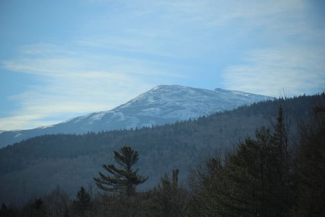
Knifes edge maine guide: discover Katahdin’s iconic ridge, route, difficulty, risks, and how to prepare for this unforgettable hike.
Knifes edge maine usually refers to the Knife Edge Trail on Mount Katahdin in Baxter State Park, Maine. The exposed 1.1-mile ridge connects Pamola Peak and Baxter Peak and is rated Very Strenuous by Baxter State Park, with steep drop-offs, scrambling, and rapidly changing mountain weather.
What You'll Discover:
Why Knifes Edge Maine Is So Famous
There is a good reason people search for knifes edge maine when planning a Katahdin adventure. The Knife Edge is one of New England’s most dramatic mountain traverses: a narrow, rocky glacial ridge with enormous views and exposure on both sides.
The name is descriptive rather than dramatic marketing. From a distance, the ridge resembles the sharp edge of a blade, and Baxter State Park identifies the feature as a glacial arête created by erosion and glacial action.
It is also important to distinguish the Knife Edge from the summit itself. Baxter Peak is the highest point on Mount Katahdin and the highest mountain in Maine; the Knife Edge is the exposed ridge connecting Baxter Peak with Pamola Peak.
That distinction matters when planning a route because reaching Baxter Peak does not automatically mean you have completed the Knife Edge.
The Knife Edge is 1.1 miles long and is classified by Baxter State Park as Very Strenuous.
Where Is the Knife Edge in Maine?
The Knife Edge is on Mount Katahdin inside Baxter State Park, in northern Maine near Millinocket. The ridge runs between Baxter Peak and Pamola Peak, forming one of the mountain’s most recognizable geological features.
Baxter State Park describes the Knife Edge as completely exposed. The park also warns that high winds and poor weather can turn the traverse into a serious emergency, and several hikers have died or suffered serious injuries while attempting it in dangerous conditions.
The landscape helps explain the danger. There is little shelter once you are on the ridge, so wind, rain, lightning, ice, and sudden temperature changes can become much more consequential than they would be on a forested trail.
How Long Is the Katahdin Knife Edge?
The Knife Edge itself is 1.1 miles one way. Baxter State Park estimates approximately one to one and a half hours each way, although actual time varies considerably with weather, congestion, scrambling ability, and how cautiously you move.
The 1.1-mile figure can be misleading for first-time visitors because it does not represent the entire hike.
If you start from Roaring Brook, for example, you still have to climb toward Pamola Peak or Chimney Pond before reaching the ridge. A full Katahdin loop involving the Knife Edge can therefore become a long, strenuous day rather than a short ridge walk.
Knife Edge at a glance
| Feature | Details |
| Location | Mount Katahdin, Baxter State Park, Maine |
| Ridge length | 1.1 miles one way |
| Connects | Pamola Peak and Baxter Peak |
| Park difficulty | Very Strenuous |
| Terrain | Exposed rock, scrambling, steep terrain |
| Water | None on the Knife Edge |
| Main hazards | Wind, lightning, rain, exposure, falls |
| Common access | Roaring Brook area |
| Best approach | Only in suitable mountain weather |
The key takeaway is simple: the Knife Edge is short in mileage but large in commitment.
What Is the Best Route for the Knife Edge?
There is no single route that works for every hiker, but a classic option is to approach from Roaring Brook, climb toward the Katahdin massif, cross the Knife Edge, and descend on another trail.
Friends of Baxter State Park highlights a popular loop that climbs from Roaring Brook via Chimney Pond and Cathedral Trail to Baxter Peak, traverses the Knife Edge toward Pamola Peak, and descends via Helon Taylor.
This route has a major advantage: you experience the ridge as part of a loop instead of hiking all the way across it and immediately reversing course.
However, it is not a casual loop. Cathedral is steep and rocky, Knife Edge is exposed, and Helon Taylor is itself very strenuous and exposed.
A classic Knife Edge loop
Roaring Brook → Chimney Pond → Cathedral Trail → Baxter Peak → Knife Edge → Pamola Peak → Helon Taylor → Roaring Brook
The direction can be reversed, but route choice should be based on current trail conditions, weather, fitness, and your comfort with scrambling rather than simply choosing the direction that looks best on a map.
Is the Knife Edge Trail Dangerous?
Yes. It is a legitimate high-exposure mountain route, not merely a scenic ridge walk.
The biggest misconception is that the danger comes from the trail being continuously razor-thin. In reality, the challenge comes from the combination of exposure, rough rock, scrambling, elevation, weather, fatigue, and limited options once you are committed to the ridge.
Baxter State Park specifically advises hikers not to leave the ridge once they have started, because some apparent shortcuts lead toward dangerous terrain.
That warning deserves attention.
A tempting descent can look straightforward from above but become far more difficult once you are on steep, loose, or vertical terrain. The safest decision is often the least adventurous one: stay on the established route and follow park guidance.
Do not treat the Knife Edge as a shortcut between two points on a map; treat it as an exposed mountain traverse.
Weather is another major factor. Baxter State Park warns that rain, wind, and lightning are particularly dangerous above treeline, where hikers have much less protection from the elements.
Who Should Hike the Knife Edge?
The Knife Edge is best suited to hikers who are comfortable with steep terrain, exposed ridges, rock scrambling, and sustained physical effort.
You do not necessarily need technical climbing experience for a summer traverse in good conditions. But you should be able to move confidently over uneven rock while maintaining three points of contact when necessary.
A useful self-test is to ask:
- Am I comfortable with significant exposure?
- Can I climb and descend steep rocky terrain without rushing?
- Can I turn around if conditions deteriorate?
- Do I have enough daylight and energy for the entire route?
- Am I prepared to hike without reliable cell service?
- Have I checked the park’s current conditions rather than relying on an old trip report?
If several answers are uncertain, a less exposed Katahdin route may be the smarter choice.
Knife Edge vs. Other Katahdin Routes
The best alternative depends on what you actually want from your day.
| Route | Character | Exposure | Best for |
| Knife Edge | Rocky ridge traverse | Very high | Experienced hikers seeking exposure |
| Hunt Trail | Classic summit approach | High above treeline | Appalachian Trail hikers and summit seekers |
| Abol Trail | Direct, steep ascent | High | Strong hikers wanting a challenging summit route |
| Saddle Trail | More gradual summit approach | Moderate to high | Hikers seeking a less exposed ascent |
| Cathedral Trail | Steep rock ascent | High | Confident scramblers |
Baxter State Park classifies the Hunt, Abol, Helon Taylor, Dudley, Cathedral, and Knife Edge routes around Katahdin according to their demanding terrain, with Knife Edge specifically listed as Very Strenuous.
If your primary goal is simply standing on Baxter Peak, you do not have to cross Knife Edge.
If your goal is experiencing the mountain’s most famous exposed ridge, however, Knife Edge is the attraction itself.
What Should You Bring?
Preparation for Knife Edge should focus less on gadgets and more on redundancy: enough food, water, clothing, light, and navigation capability to cope if the day takes longer than expected.
Baxter State Park emphasizes that hikers should not rely on cell phone service in the park when planning for emergencies.
For a summer Knife Edge hike, consider:
- Sturdy hiking footwear with reliable traction
- Plenty of water and high-energy food
- Waterproof and insulating layers
- Wind protection
- Headlamp, even for a planned daytime hike
- Offline map or physical map
- Basic first-aid supplies
- Emergency clothing appropriate to the forecast
- Trekking poles for approach and descent, where useful
The most important piece of equipment, though, is judgment.
A $300 jacket cannot compensate for starting an exposed ridge in a thunderstorm.
When Is the Best Time to Hike Knife Edge?
For most hikers, the practical season is the warmer, more predictable part of the year, but even summer does not guarantee safe conditions.
Baxter State Park notes that mountain weather can change quickly, and conditions above treeline can become dangerous with rain, wind, or lightning.
For that reason, choose the day based on the forecast, not simply the calendar.
A beautiful August morning can deteriorate quickly. Conversely, a cool day with stable weather may offer excellent hiking conditions.
Winter and shoulder-season conditions are a completely different proposition. Snow, ice, short daylight, extreme cold, and difficult rescue conditions substantially increase the technical and logistical demands.
How Baxter State Park Reservations Work
One of the practical details often missed in Knife Edge guides is that getting to the trailhead involves park logistics, not simply driving up and parking.
Baxter State Park uses a Katahdin Trailhead Pass system to manage visitor impacts on Katahdin’s heavily used alpine trails and prevent overcrowding.
The official reservation system currently lists Katahdin Trailhead Passes and states that they become available beginning April 1 at 6:00 a.m. Eastern Time for the applicable season.
Roaring Brook is particularly important for Knife Edge hikers because it provides access toward Chimney Pond and several routes leading into the Katahdin massif.
Before leaving home, confirm:
- Your trailhead access.
- Your parking or camping reservation requirements.
- Current trail conditions.
- Weather at elevation.
- Any temporary trail or road work.
- Your turnaround time.
The park’s official conditions information is more valuable than an old blog post because Katahdin conditions can change from one day to the next.
What Is Different About Katahdin Weather?
Katahdin has a reputation for changing character quickly, and that reputation is deserved.
A sunny forest approach can create a false sense of security. As you climb above treeline, temperatures, wind exposure, cloud cover, and precipitation can become dramatically different from conditions at the parking area.
That is why a forecast for nearby Millinocket should not be treated as a perfect substitute for understanding conditions on the mountain itself.
Mountain weather matters more than the weather at the trailhead.
Baxter State Park recommends checking conditions and preparing for unexpected changes, including precipitation and cold weather above treeline.
A Better Way to Decide Whether to Cross
The smartest Knife Edge hikers are not necessarily the strongest ones. They are the ones willing to change plans.
Use a simple decision framework before committing to the ridge:
Green light
Weather is stable, visibility is good, winds are manageable, you have ample daylight, and everyone in the group is moving confidently.
Yellow light
Clouds are building, wind is increasing, someone is tiring quickly, or progress is substantially slower than planned. Pause, reassess, and consider turning around.
Red light
Lightning, severe wind, heavy rain, icy conditions beyond your experience, deteriorating visibility, or an injury makes the ridge unsafe.
Do not let the fact that you have already climbed for hours force you into a dangerous traverse. Distance already traveled is not a reason to accept greater risk.
Common Mistakes on the Knife Edge
One of the most common mistakes is underestimating the total hike because the ridge itself is only 1.1 miles.
Another is assuming that a good forecast at the trailhead means the ridge will be comfortable. Above treeline, exposure changes the equation dramatically.
Other avoidable mistakes include starting too late, carrying too little water, failing to bring a headlamp, wearing inadequate footwear, and treating the route like a normal maintained hiking path.
There is also a dangerous psychological trap: once hikers reach the ridge, they may feel committed because they have already invested so much effort.
That is exactly when disciplined decision-making matters most.
What Makes the Knife Edge Worth It?
The difficulty is only part of the appeal.
The Knife Edge gives hikers an unusually direct sense of Katahdin’s scale. Instead of looking at a dramatic ridge from a distant viewpoint, you move along it, with the mountain falling away on either side and the landscape of northern Maine stretching toward the horizon.
The geological story is equally fascinating. Baxter State Park identifies the Knife Edge as a glacial arête, part of the larger landscape carved by glaciers that shaped Katahdin’s cirques and valleys.
There is also a human history attached to the ridge. Percival Baxter, whose vision ultimately led to the creation of Baxter State Park, crossed the Knife Edge during a 1920 expedition to Katahdin. Friends of Baxter State Park recount that the experience reinforced his determination to protect the mountain and its surrounding wilderness.
So the Knife Edge is more than a difficult trail. It sits at the intersection of geology, wilderness conservation, Maine history, and mountaineering.
FAQ
How long is Knife Edge in Maine?
The Katahdin Knife Edge is approximately 1.1 miles one way between Pamola Peak and Baxter Peak. Baxter State Park estimates roughly one to one and a half hours for the traverse in suitable conditions.
Is Knife Edge harder than the Hunt Trail?
They are difficult in different ways. The Hunt Trail is a long, very strenuous ascent to Baxter Peak, while Knife Edge adds significant exposure and scrambling to the experience. Baxter State Park rates Knife Edge as Very Strenuous.
Can beginners hike the Katahdin Knife Edge?
Beginners should be cautious. Someone new to exposed scrambling or uncomfortable with heights may find Knife Edge inappropriate, even if they are otherwise fit.
Can you hike Knife Edge in bad weather?
No. Baxter State Park explicitly warns against attempting the Knife Edge in inclement weather or high winds because of the severe exposure.
Is Knife Edge open in 2026?
Baxter State Park reported that all park trails were open for hiking beginning June 10, 2026, although hikers were warned about spring conditions at that time. Because trail conditions can change, visitors should check the park’s current daily conditions before setting out.
Key Takeaways
- Knifes edge maine generally refers to the Knife Edge Trail on Mount Katahdin in Baxter State Park.
- The ridge is 1.1 miles one way between Pamola Peak and Baxter Peak.
- Baxter State Park classifies Knife Edge as Very Strenuous.
- The biggest hazards are exposure, wind, lightning, rain, rough rock, fatigue, and changing mountain weather.
- You do not need to cross Knife Edge to summit Baxter Peak.
- Roaring Brook is the key access area for many Knife Edge routes.
- A Katahdin Trailhead Pass may be required for day-use access, so check the official reservation system before traveling.
- The best Knife Edge hike is not necessarily the most ambitious one; it is the one that matches the day’s weather, trail conditions, fitness, and experience.
Additional Resources
- Baxter State Park, Hiking: The park’s official hiking guide provides route distances, elevation gains, difficulty ratings, trailhead information, and important Knife Edge safety warnings.